
1. The Perspective from 700 kilometers up
Every day, a silent fleet of satellites circles our planet, capturing millions of high-resolution images of the Earth’s surface. For decades, this ‘eye in the sky’ has been the primary tool for climate scientists tracking melting glaciers or ecologists monitoring deforestation. But at SESAC, we believe these pixels hold the key to a different kind of story: the human one.
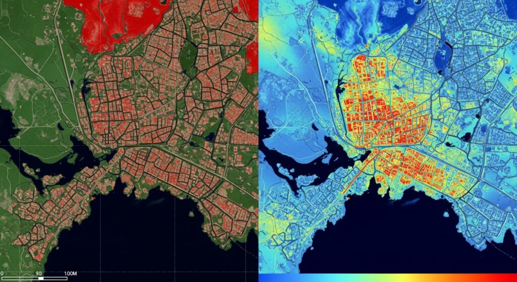
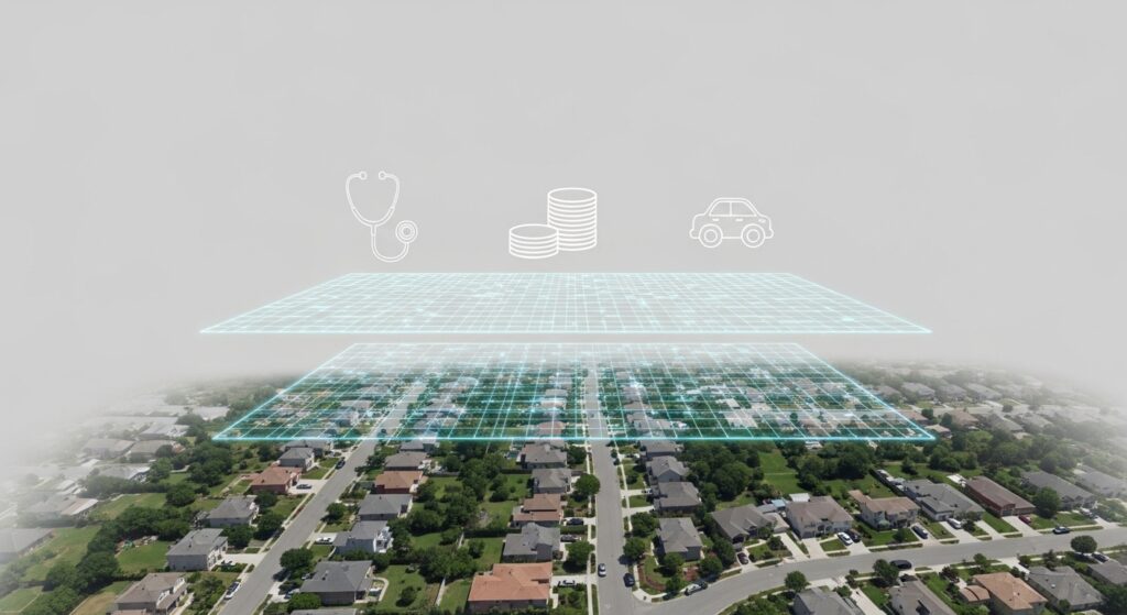
When you look at a satellite image of a city, you aren’t just seeing rooftops and roads. You are seeing the physical footprint of human decisions, economic shifts, and social inequality. A change in nighttime lights can signal a blossoming local economy or the onset of a crisis. The density of urban greenery can reveal deep-seated patterns of health and well-being. The shifting boundaries of agricultural land in conflict zones can tell us more about food security than any traditional survey could.
The data is there, orbiting above us right now. The challenge has always been the Gap – the technical barrier that kept these powerful insights out of the hands of social scientists and policymakers. Today, that changes.
2. The Mission. Why Now?
The perfect storm: Data, AI, and Social Need
We are living in an era of unprecedented data availability. Through the European Union’s Copernicus program, petabytes of free, high-quality satellite data are generated every day. Simultaneously, the rise of Machine Learning and GeoAI has given us the ‘brainpower’ to process this imagery at a scale that was impossible just five years ago.
However, data alone is not enough. To truly understand societal change, we must connect these ‘pixels’ to the people they represent.
The Swedish Advantage
Swedish is uniquely positioned to lead this frontier. By fusing global satellite feeds with our nation’s world-class, detailed socio-economic registers, SESAC creates a laboratory for ‘precision social science’. We aren’t just looking for patterns; we are seeking to explain why they happen.
Our Core Objective: SESAC isn’t just about high-end research. Our mission is to democratize space technology. We are building a national competence centre that provides:
- Open-access workflows so researchers can replicate findings.
- Reusable tools for local municipalities and public agencies.
- A collaborative bridge where technical geographers and social scientists work side-by-side.
3. A National Strategic Alliance
A Unified Engine of Interdisciplinary Expertise
SESAC is the result of a powerful strategic union between Sweden’s leading academic and research centres. By pooling our collective resources, we have created a national powerhouse where the technical precision of geomatics and AI-driven data science meets the deep analytical insights of human geography and computational sociology.
This alliance allows us to operate at the cutting edge of ‘Space-Enabled Social Science’. Our combined strengths enable us to process massive amounts of satellite imagery and fuse them with Sweden’s unique socio-economic data, creating a research environment that is greater than the sum of its parts. This collaborative approach ensures that every pixel we analyze is grounded in rigorous social theory and every model we build is designed for real-world impact. We are not just sharing a project; we are building a national infrastructure for the future of social analysis.
The Strategic Support of Rymdstyrelsen
This national endeavor is made possible through the visionary support and funding of the Swedish National Space Agency (Rymdstyrelsen). Through their support, SESAC is positioned as a key pillar in Sweden’s national space strategy, ensuring that the benefits of space technology reach every level of Swedish society.
4. The Road Ahead – From Data to Discovery
The launch of SESAC is just the beginning of a three-year journey to redefine how we understand our society. We aren’t just building a centre; we are building a community. In the coming months, you can expect to see the SESAC in action through several key initiatives:
- The Knowledge Hub: We will be launching an open-source digital repository featuring reusable workflows and tutorials. Whether you are a seasoned GIS expert or a social science student, these tools will help you integrate Earth Observation into your own research.
- The SESAC Hackathons: Innovation happens when different minds collide. We will host national hackathons bringing together coders, geographers, and urban planners to solve real-world challenges, from urban heat islands to regional economic shifts.
- Science Communication & Storytelling: Through our dedicated YouTube channel and website, we will continue to translate complex satellite analytics into accessible, layman-friendly stories. We believe that for data to have an impact, it must be understood by everyone.
A Lasting Legacy for Sweden
Our ultimate goal is to ensure that by the end of this project, satellite-enabled analytics is no longer a ‘niche’ field, but a standard tool in the Swedish research and policy toolkit. By looking at our world from above, we gain the clarity needed to make better decisions on the ground, for sustainability, for equality, and for the resilience of our society.
We are ready to lift off. We hope you’ll join us.
Join the Journey
Subscribe to our YouTube Channel for tutorials, webinars, guest talks, and project updates.
Follow us on LinkedIn to stay informed about our upcoming Inauguration session and project updates.
Visit our Events page to register for future webinars, hackathons, and other events.
Leave a Reply